Press kit

Everything you need to write about Huck: screenshots, marks, a fact sheet and boilerplate you can paste. Free to use in editorial coverage, no need to ask. If you want something that is not here, email hello@huck-app.com and I will make it.

Download the full kit (3.6 MB)View on the App StoreUpdated August 7, 2026

Fact sheet

Platform
iPhone, iOS 17.0 or later
Released
16 June 2026
Price
Free to download. Three identifications a day at no cost, Huck Premium for unlimited.
Category
Education
Species
8,600+ in the field guide
Illustrations
2,600+ original hand-drawn plates
Developer
Zack Peck, Phoenixville, Pennsylvania

Boilerplate

Written to be pasted as is. Both are accurate as of the date above.

SHORT

Huck is an iPhone field guide that identifies any wild plant or animal from a photo and maps what naturalists are spotting near you, illustrated by hand.

LONG

Huck is a wildlife field guide for iPhone. Point it at any plant, bird, fish, insect, reptile or mammal and it names the species in seconds, then adds it to a collection you build as you go. A live map shows recent research-grade sightings nearby, so you can find things on purpose rather than by luck. All 8,600+ species are illustrated by hand in a vintage field-guide style. Free to download, with a premium tier for unlimited identifications.

Screenshots

Unframed captures at full device resolution, 1320 by 2868. Click any one to open the full-size file. Crop or drop them into device frames as you like.
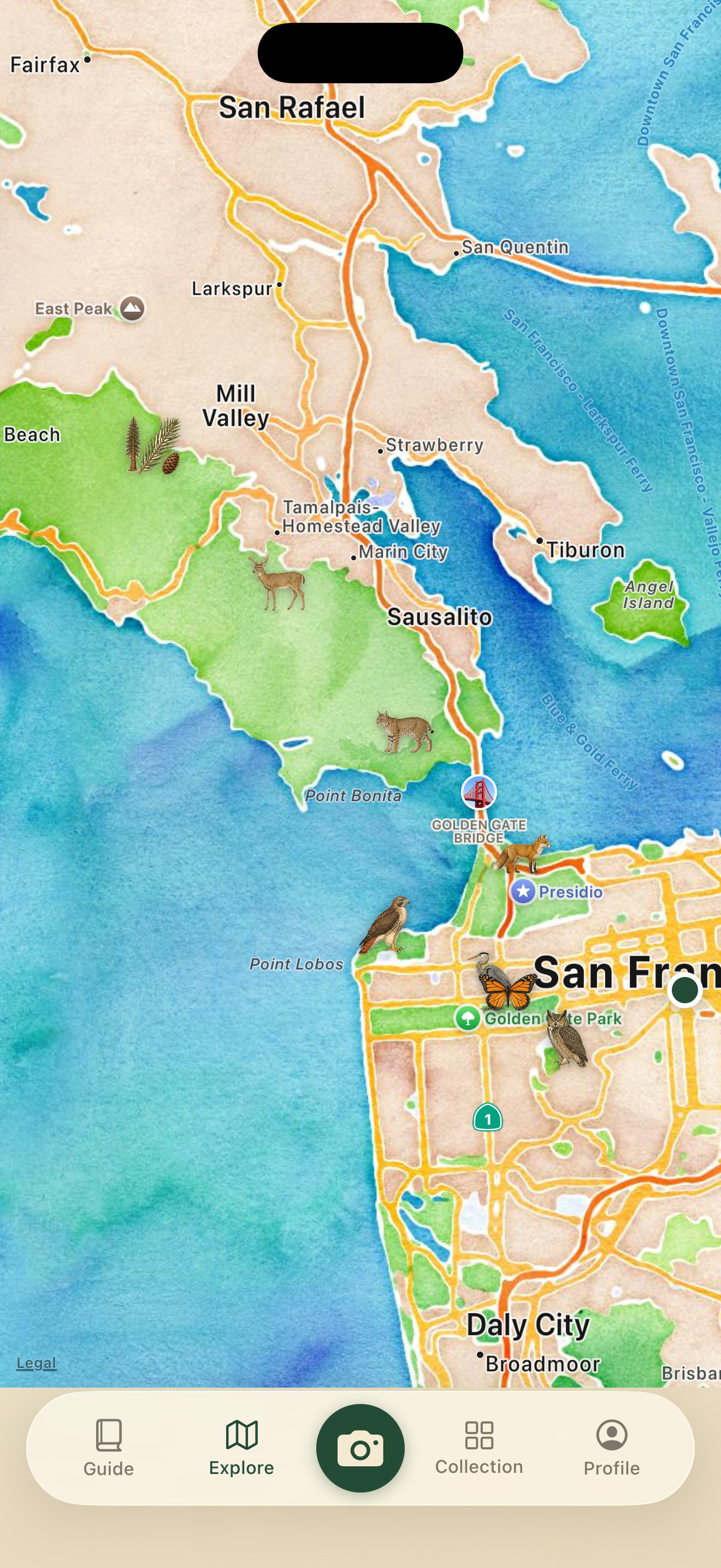
Huck app screenshot: Live sightings map
Live sightings map
Recent research-grade sightings, illustrated rather than pinned.
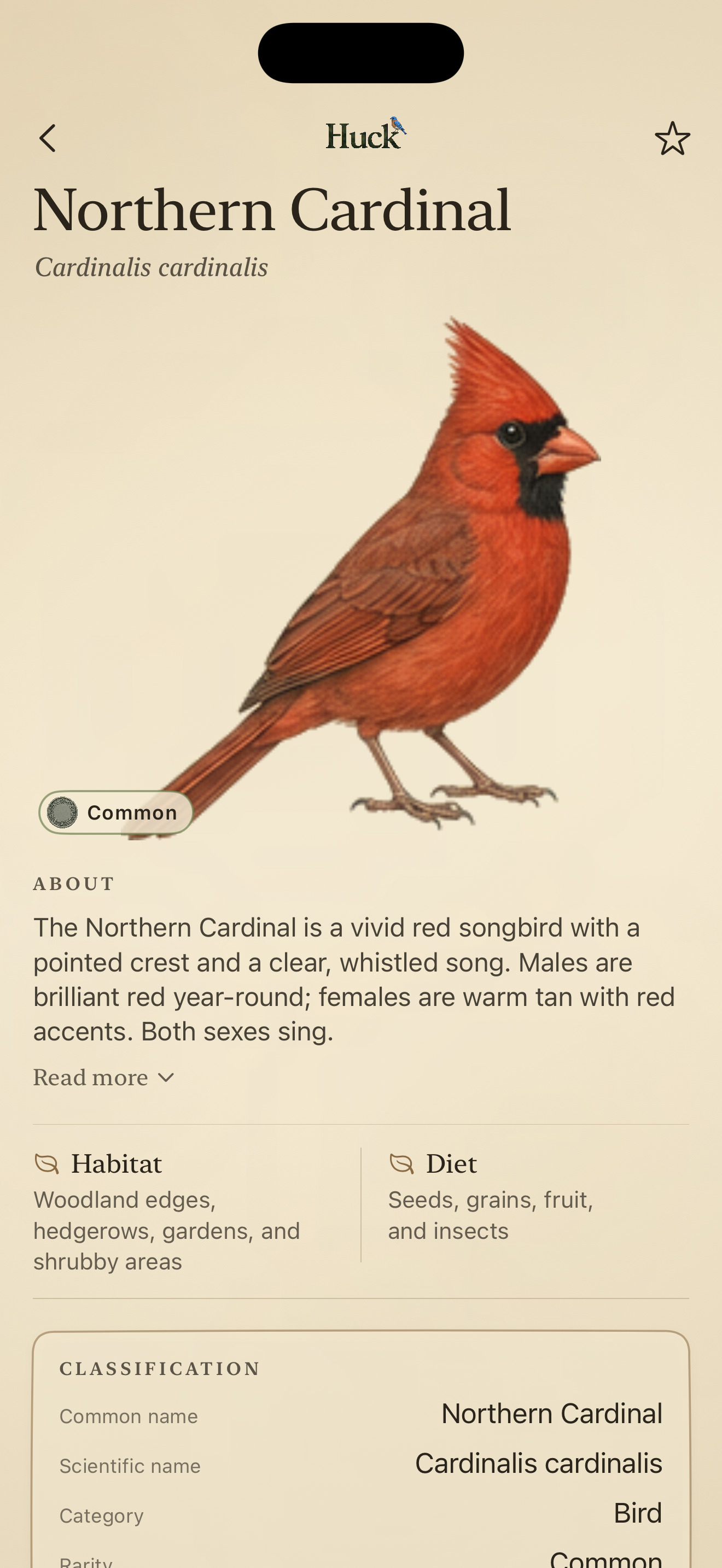
Huck app screenshot: Species page
Species page
Hand-drawn plate, habitat, diet and classification.
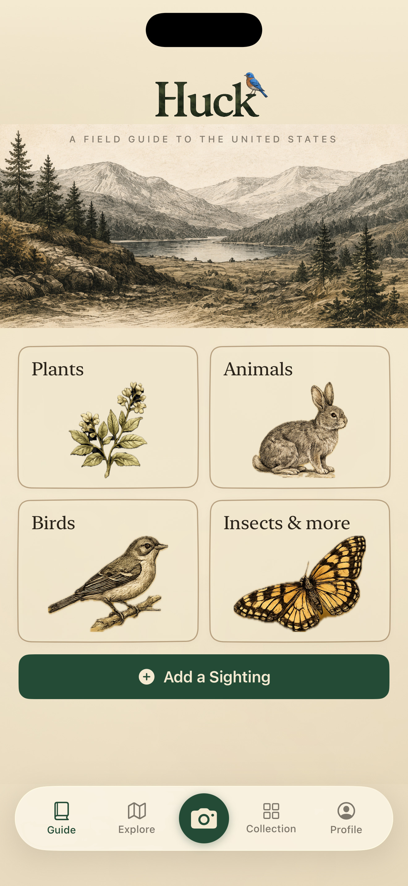
Huck app screenshot: The field guide
The field guide
Browse by group, all illustrated in one style.
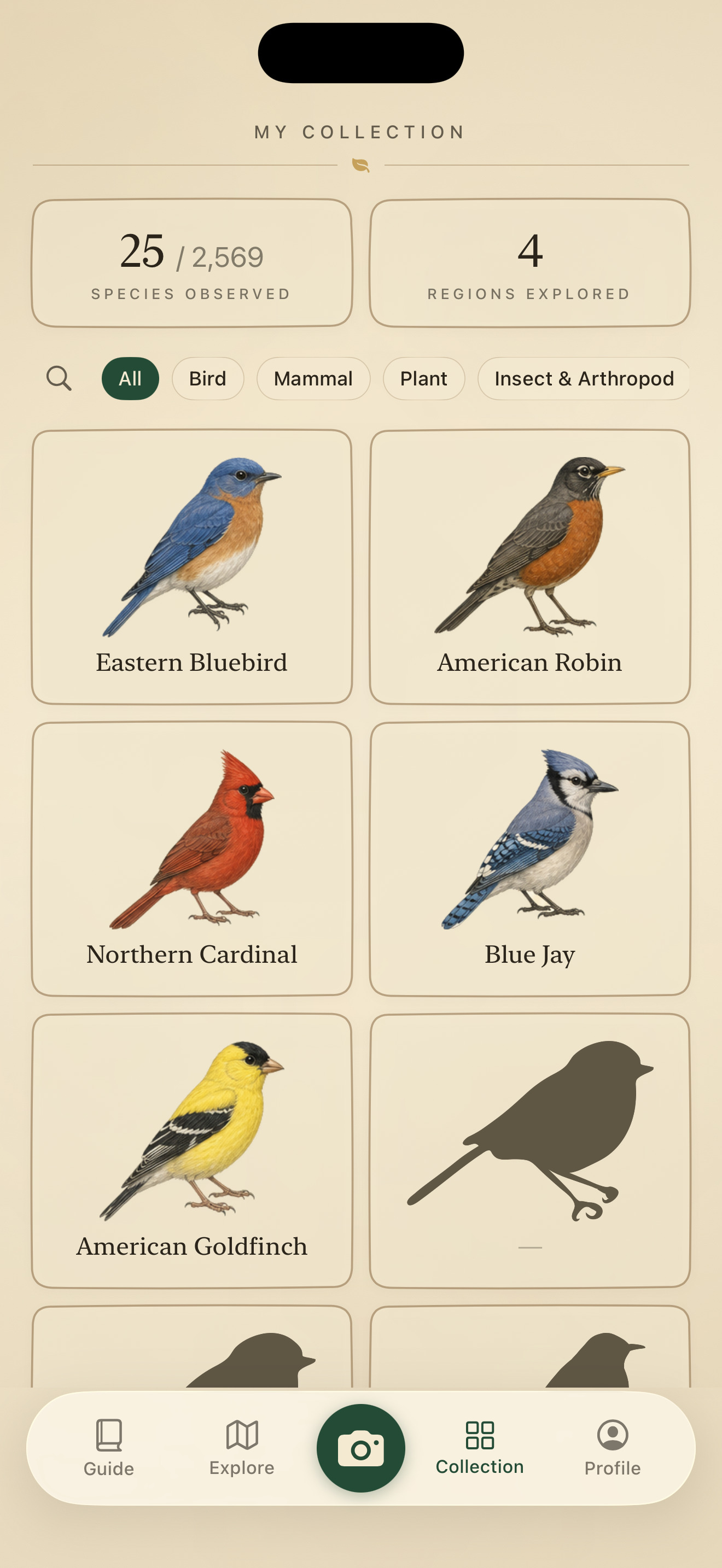
Huck app screenshot: Your collection
Your collection
Everything you have identified, kept as a personal guide.
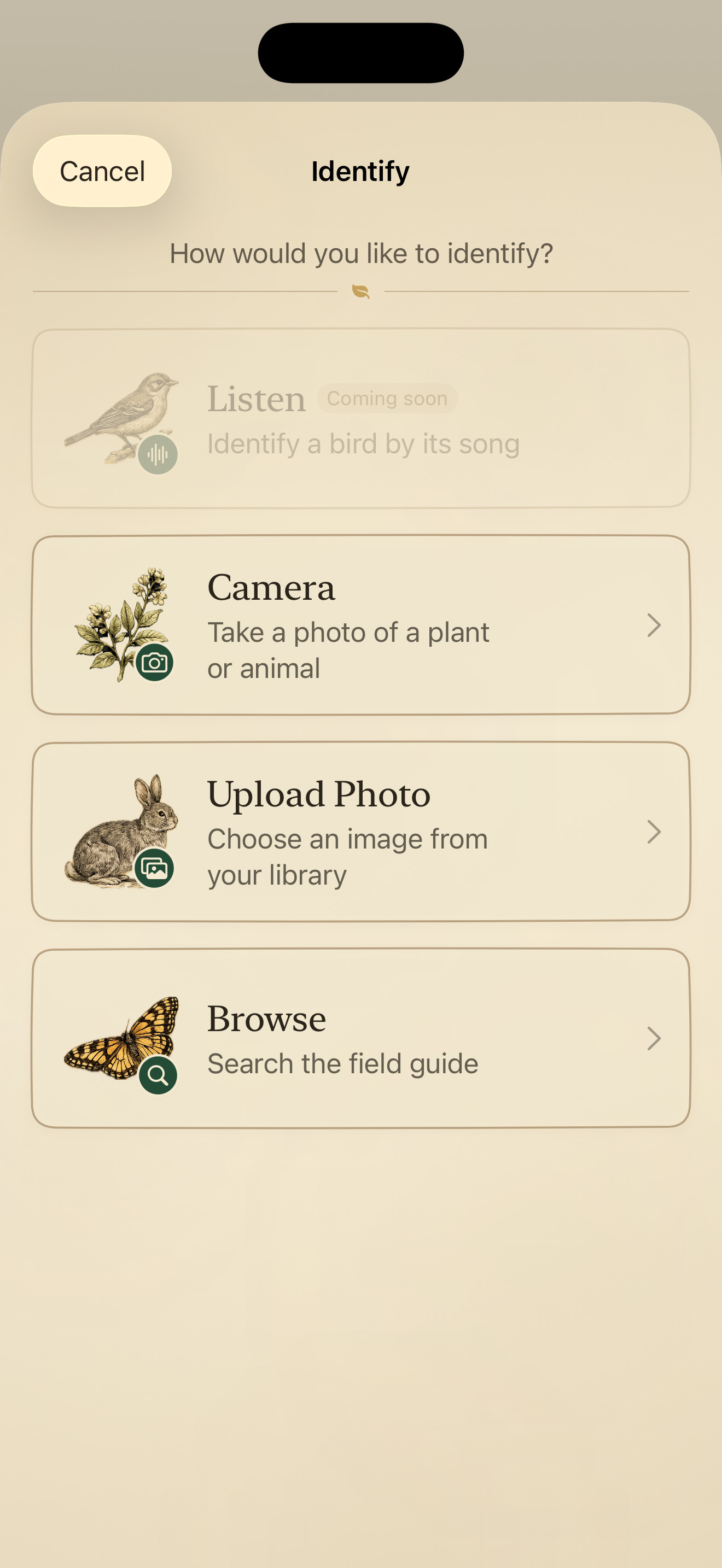
Huck app screenshot: Identifying a find
Identifying a find
Camera, photo library, or browse the guide by hand.
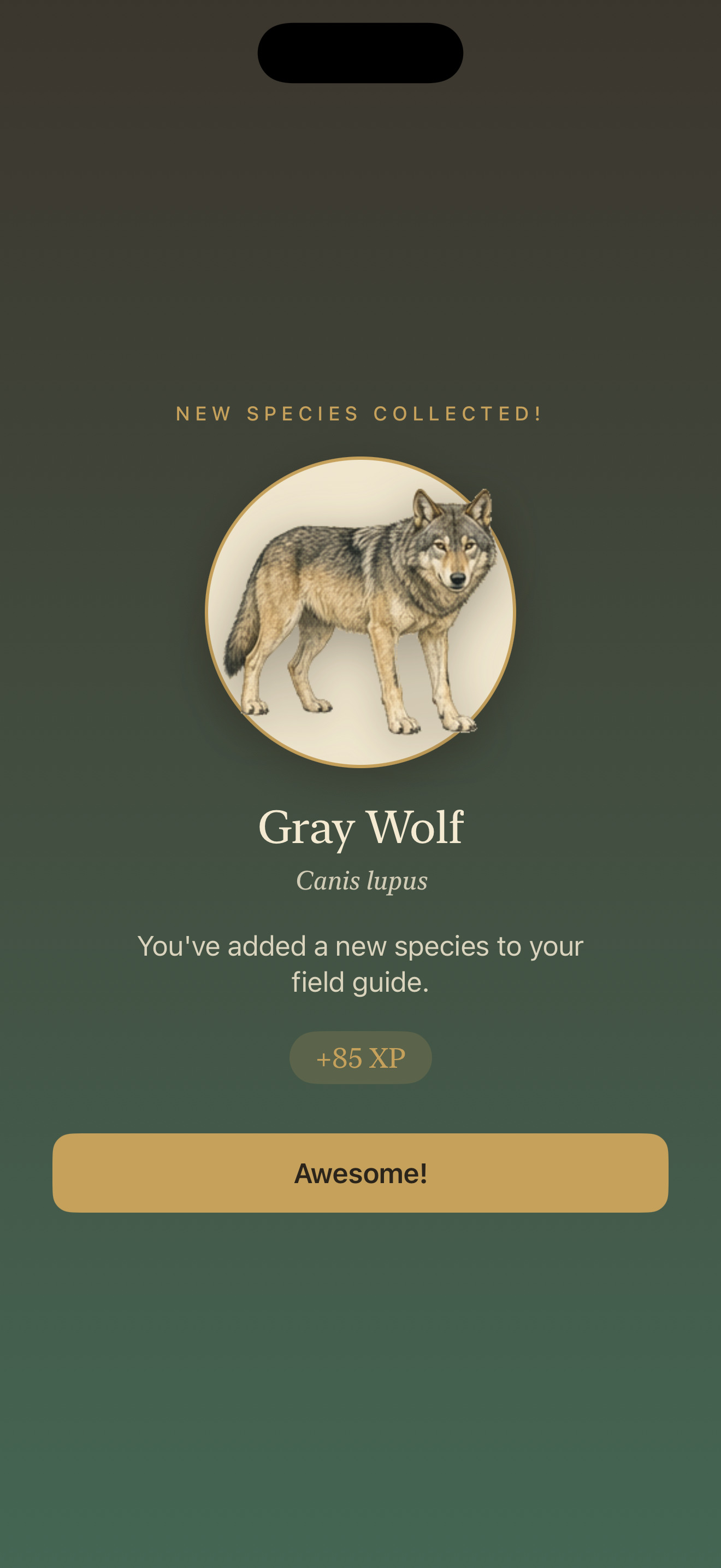
Huck app screenshot: Adding a species
Adding a species
Rarity is scored, so uncommon finds are worth more.

Logo and app icon
Huck wordmark
Download wordmark
PNG, transparent
Huck app icon
Download app icon
PNG, 1024 by 1024

Using these

Use any of it in editorial coverage of Huck without asking. Screenshots can be cropped or framed. Please do not stretch or recolour the logo or icon, and please do not use them in a way that implies a partnership or endorsement that does not exist.

Species illustrations shown inside the app are original artwork owned by Huck. Sightings data on the map comes from iNaturalist contributors under Creative Commons licences and carries its own attribution in the app.

Story assets: the Field Notes maps

Every data story we publish comes with an original sightings map, and all of them are free to run in editorial coverage with credit. Click a map for the full-size file. Suggested credit: Map: Huck (huck-app.com), from iNaturalist community observations. Want a version cropped to your coverage area, higher resolution for print, or the underlying data? Email hello@huck-app.com and it usually takes a day.
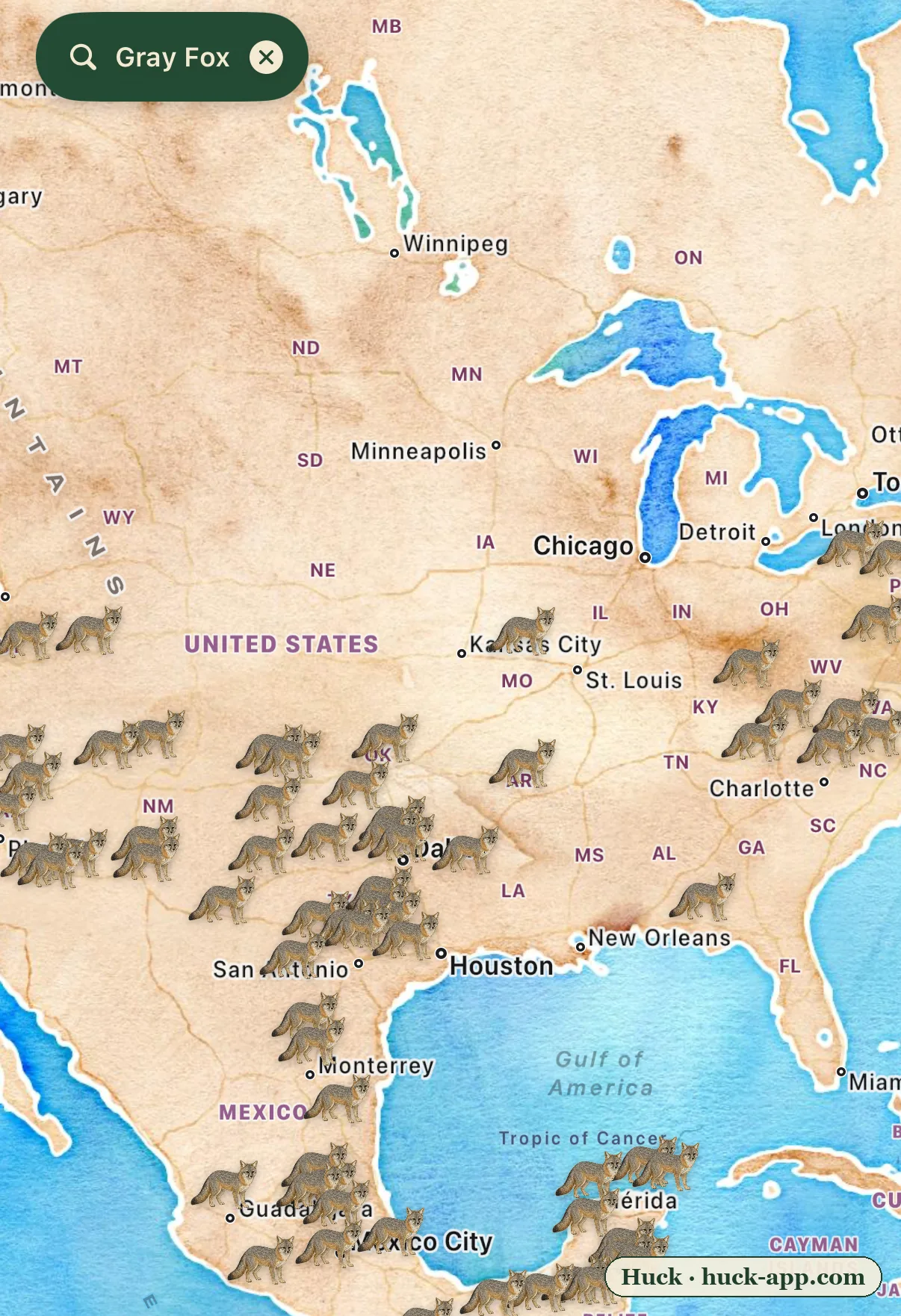
Illustrated map showing gray fox sightings dense across the Southwest, Appalachians, Southeast, and into Mexico, but nearly absent from the Midwest and northern plains
The gray fox climbs trees like a cat. The red fox learned to live with us. Only one is winning.
Download map
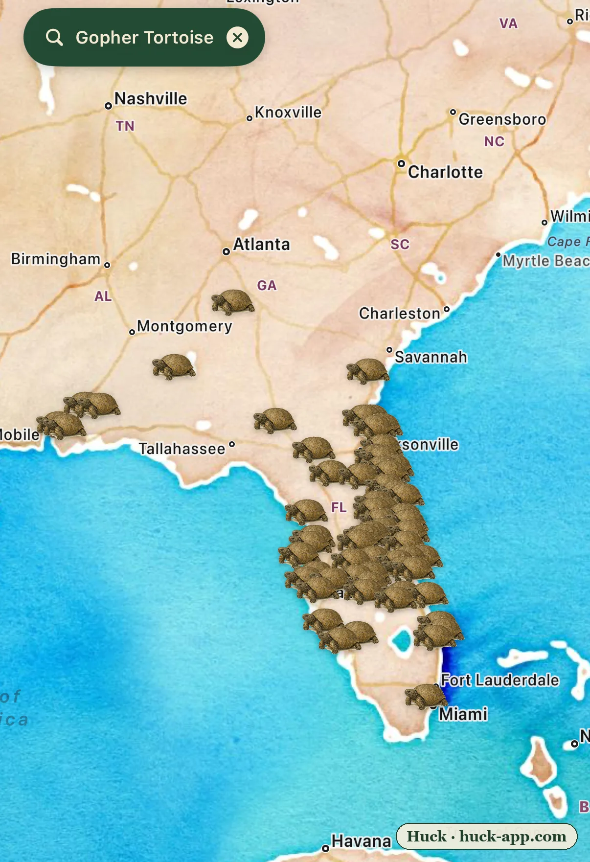
Illustrated map of the Southeastern United States showing gopher tortoise sightings dense across Florida and up into Georgia, coastal South Carolina, and the Alabama Gulf Coast
A single gopher tortoise burrow shelters 350 other species. Florida is paving over them.
Download map
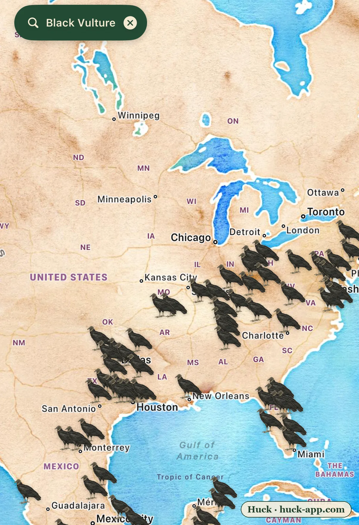
Illustrated map of the United States showing black vulture sightings dense across the Southeast and Texas and pushing north into the lower Midwest and up to Pennsylvania, with nothing above that line
The turkey vulture smells death from a mile off. The black vulture cheats off its nose, and it’s moving north.
Download map
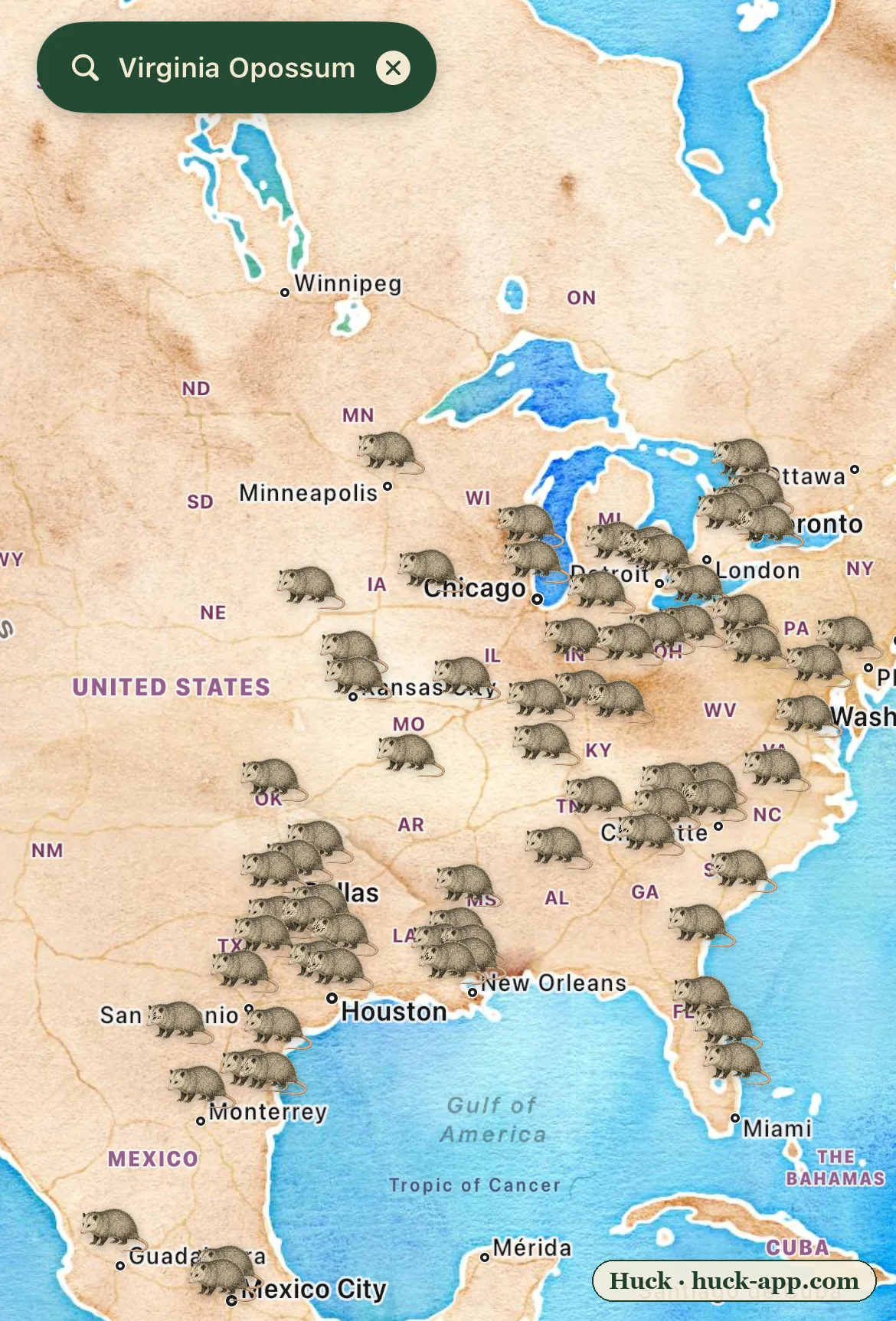
Illustrated map of North America showing Virginia opossum sightings dense across the eastern United States and pushing north into Minnesota, Michigan, and Ontario, absent from the arid interior West
The opossum is North America’s only marsupial, and almost everything you believe about it is wrong
Download map
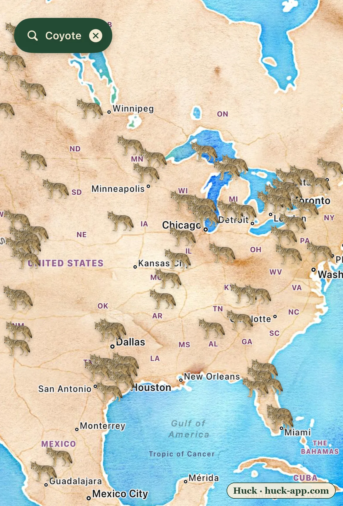
Illustrated map of the United States showing coyote sightings in every mainland state, coast to coast, dense across the Great Lakes, Northeast, Southeast, and Texas
The eastern coyote is part wolf, and it lives in every town now
Download map
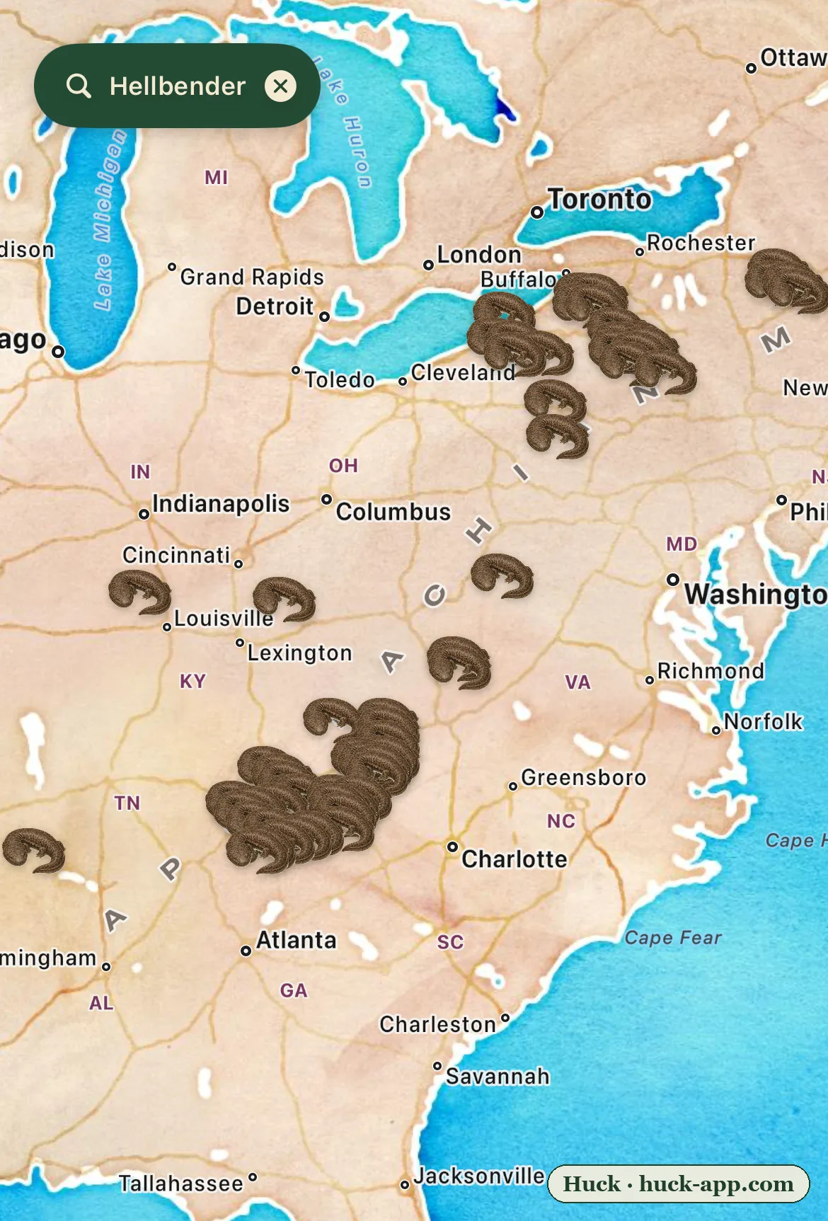
Illustrated map of the eastern United States showing hellbender sightings concentrated along the southern Appalachians and the Allegheny, scattered through the Ohio and Tennessee valleys, absent from the lowlands
The hellbender is a two-foot salamander that only lives in clean water. The map shows where Appalachia still has it.
Download map
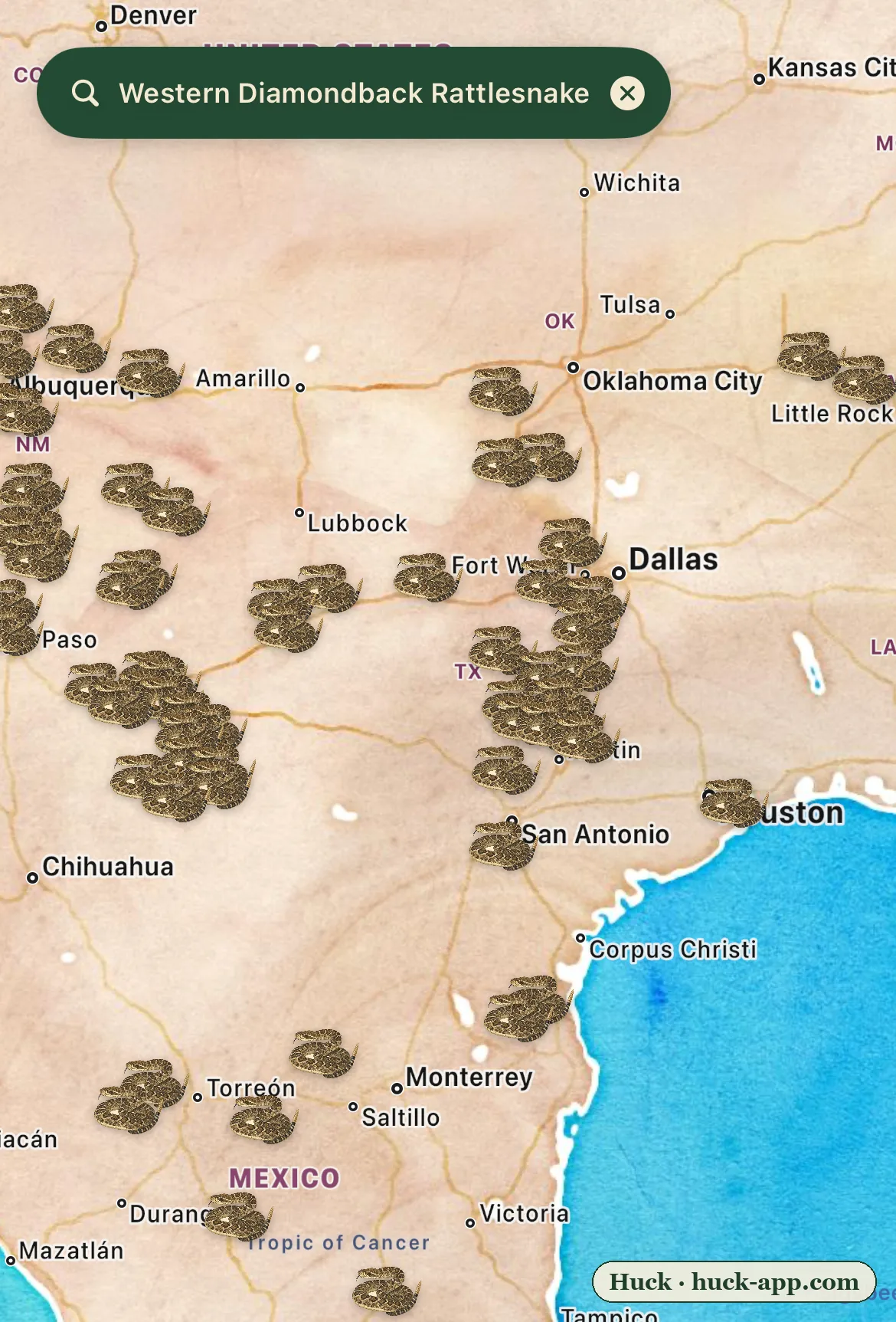
Illustrated map of Texas and the Southwest showing western diamondback rattlesnake sightings blanketing the state, densest across the west-central Texas roundup country
America still gasses rattlesnakes out of the ground by the ton, and the map shows the cost
Download map
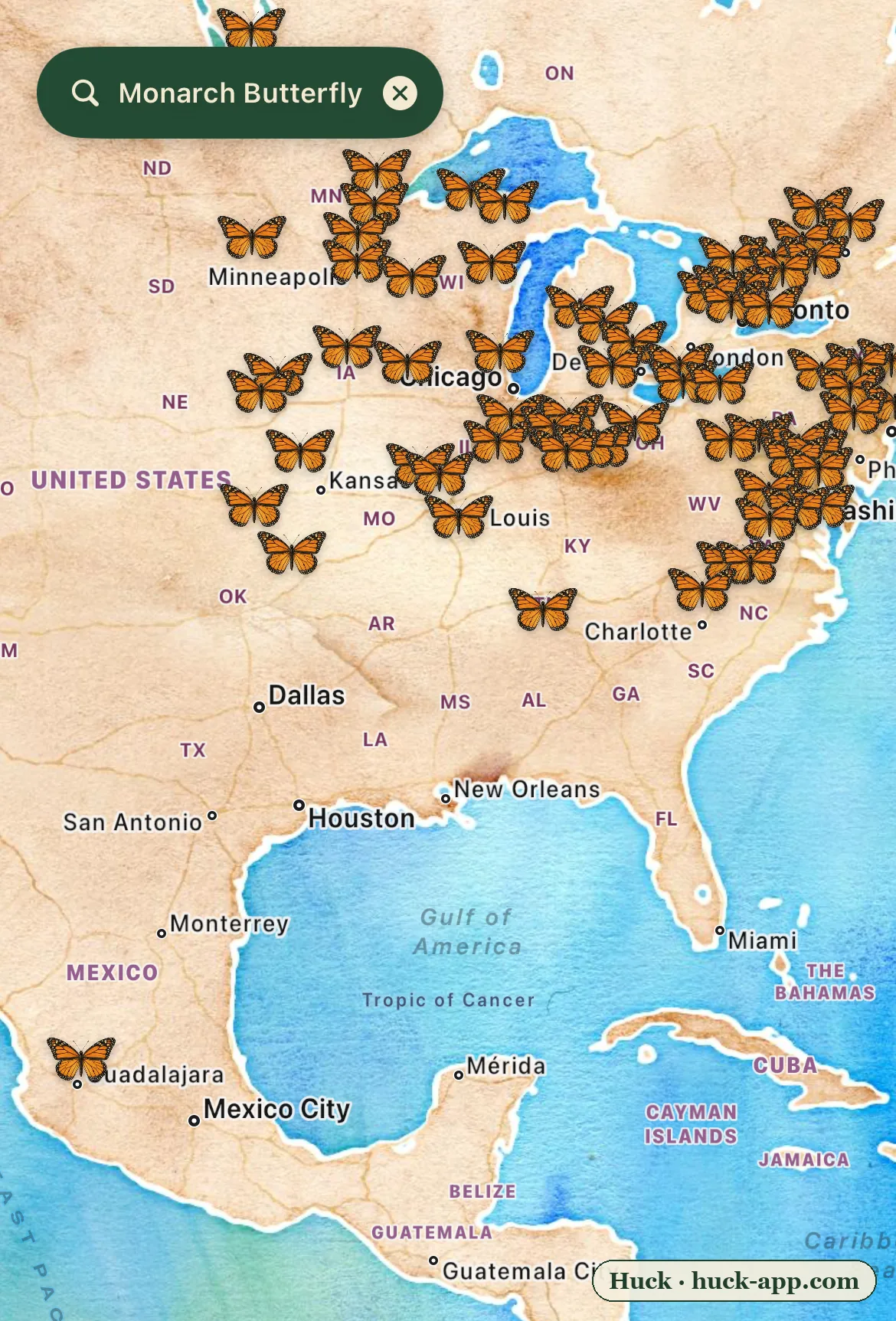
Illustrated map of eastern North America showing monarch butterfly sightings dense across the Midwest and Northeast in late summer, with a single cluster far south near central Mexico where the migration ends
The monarch migration is happening right now, and Washington is deciding whether it survives
Download map
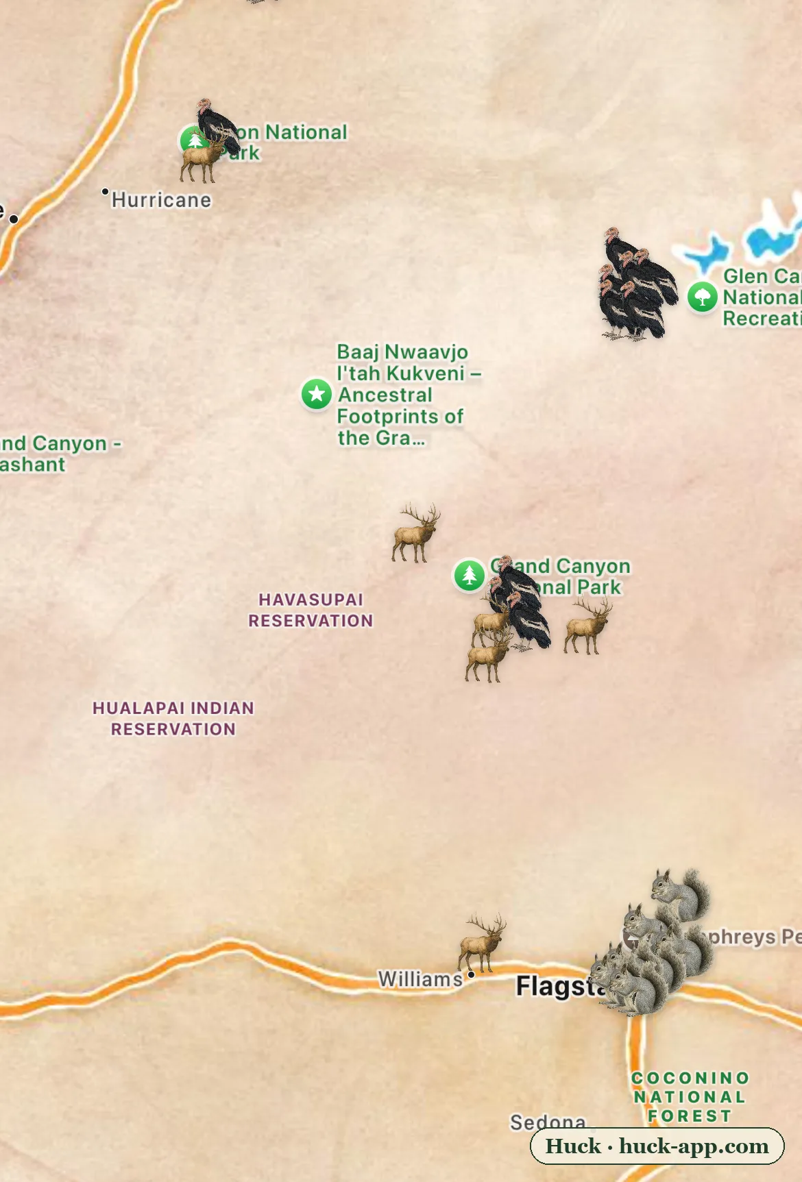
Illustrated map of the Grand Canyon region showing California condor sightings near Vermilion Cliffs and Marble Canyon, elk at the South Rim, and Abert’s squirrels in the ponderosa forest around Flagstaff
What Animals Live in the Grand Canyon?
Download map
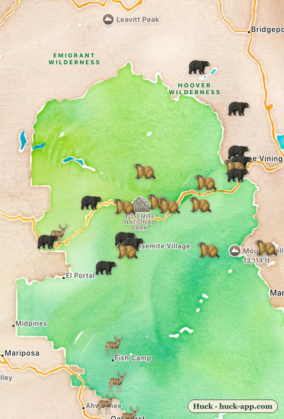
Illustrated map of Yosemite National Park with the park shaded green, showing black bear sightings along the Tioga Road corridor, yellow-bellied marmots in the high country, and mule deer near the southern entrances
What Animals Live in Yosemite?
Download map
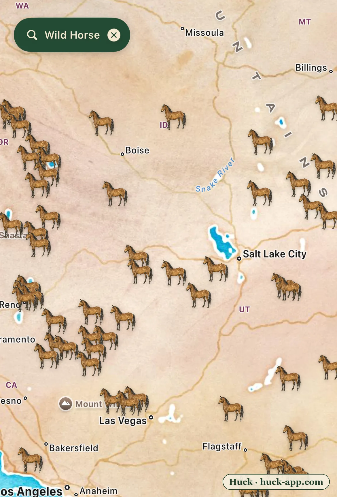
Illustrated map of the American West showing wild horse sightings blanketing the Great Basin across Nevada, Utah, Oregon, Idaho, and Arizona
America has two kinds of wild horse country, and they could not be less alike
Download map
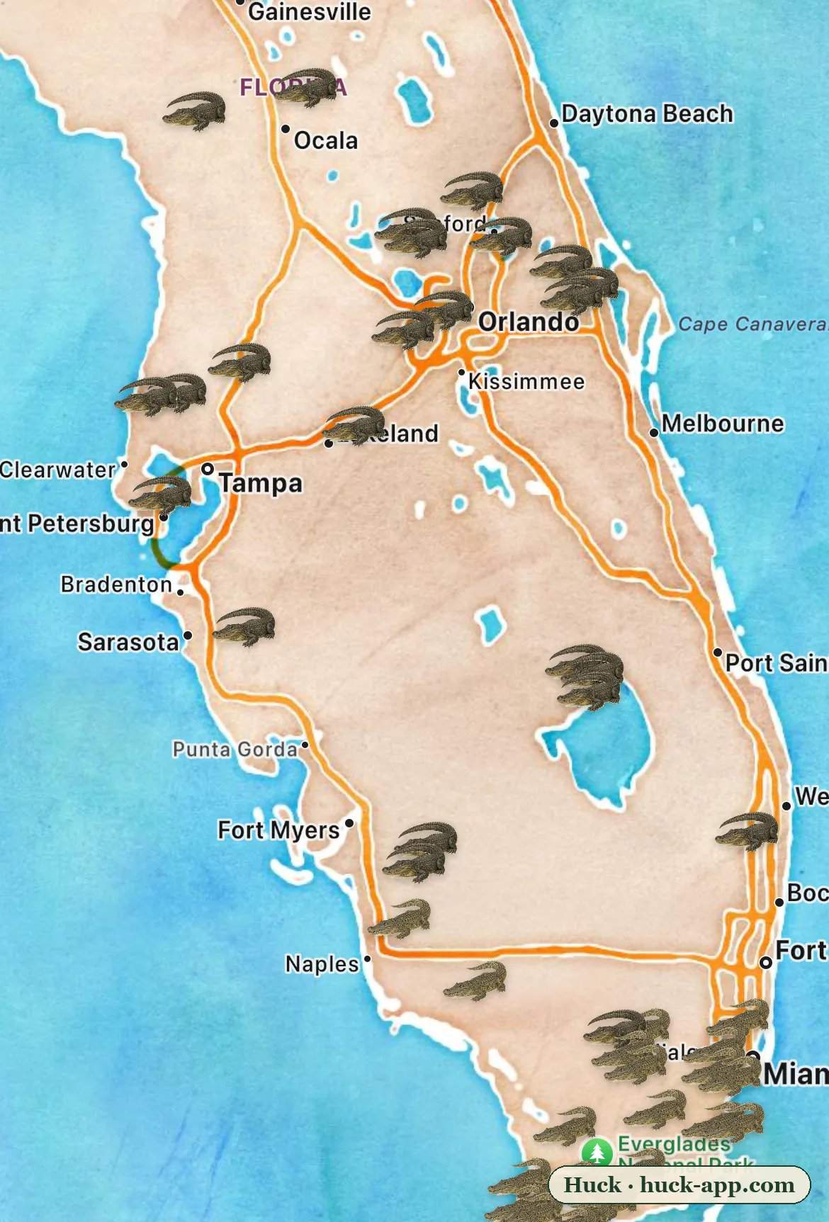
Illustrated map of the Florida peninsula showing alligator sightings spread across the whole state and American crocodile sightings clustered at the southern tip around the Everglades, Florida Bay, and Miami
Alligators and crocodiles coexist in exactly one place on Earth
Download map
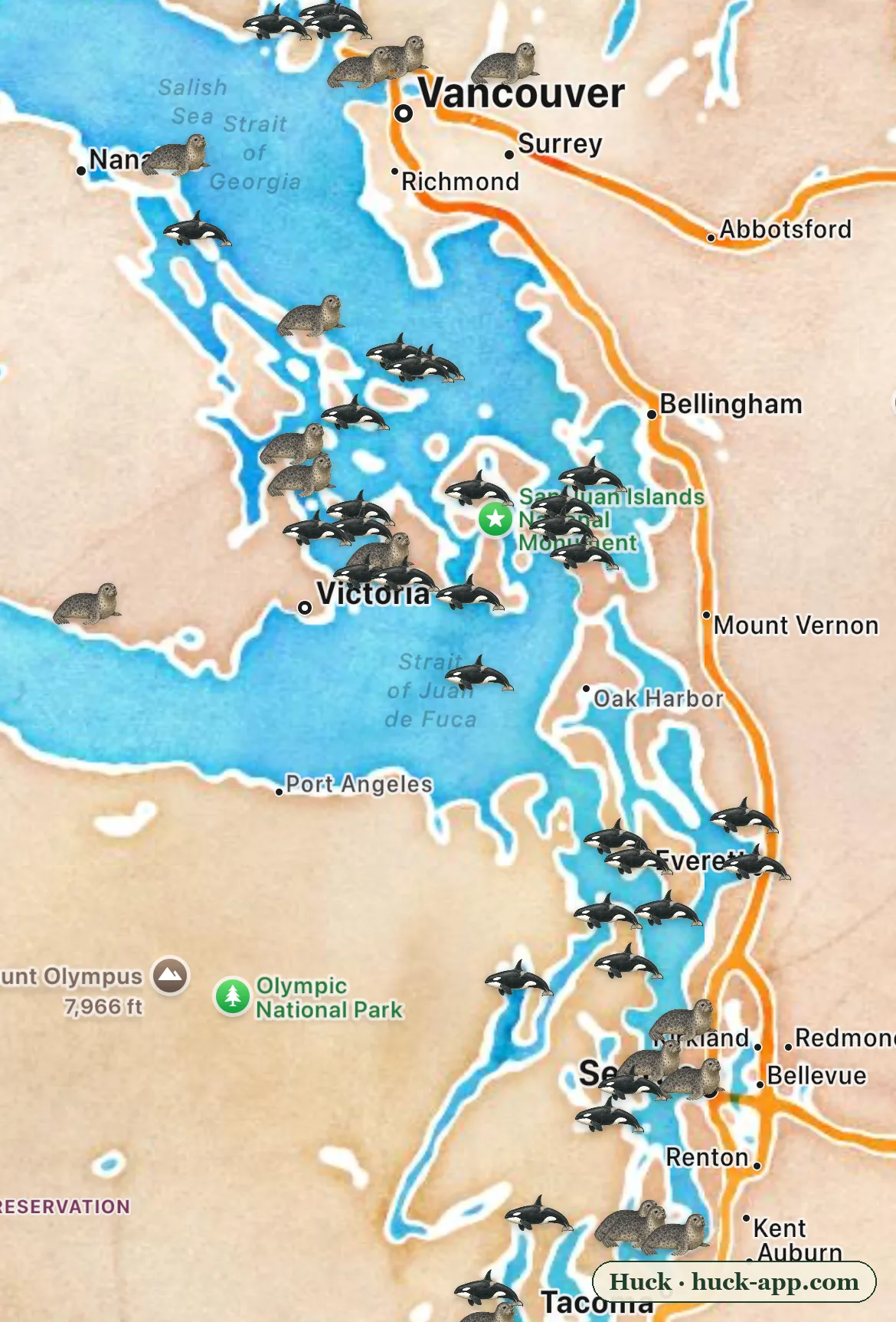
Illustrated map of the Salish Sea from Vancouver to Tacoma showing killer whale and harbor seal sightings threaded together through the San Juan Islands, Haro Strait, and Puget Sound
The Salish Sea has two kinds of killer whale, and they ignore each other
Download map
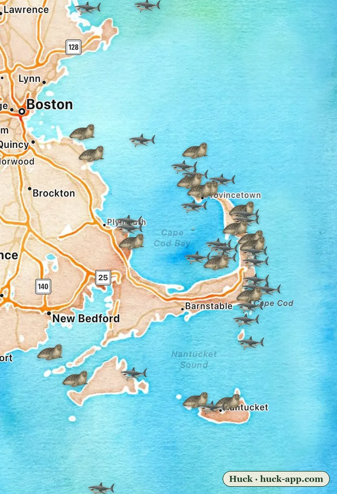
Illustrated map of Cape Cod showing white shark and gray seal sightings clustered along the outer beaches from Provincetown to Monomoy and Nantucket
The Cape Cod shark map is really a seal map
Download map

Contact

Zack Peck, who builds Huck. hello@huck-app.com. Happy to answer questions, get you a build, or put together a specific screenshot or short clip for a story.

More about Huck