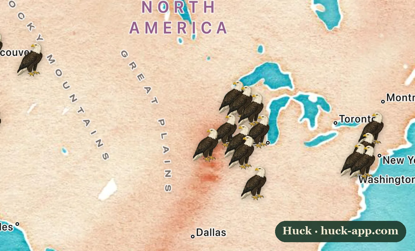
The national bird is easiest to find when it is coldest out. As lakes and rivers freeze across the north, bald eagles drift south and downstream and crowd into the few places the water stays open and the fishing stays good, below dams, at warm-water outflows, along the big rivers. They gather there by the dozens, sometimes by the hundreds, perched shoulder to shoulder in bare winter trees. The map shows the famous gathering grounds, and winter is the season to stand under one.
Why they pile up in winter
An eagle wants two things in January: open water with fish it can catch, and a sheltered patch of big trees to roost in overnight. Dams deliver the first, churning out ice-free water full of stunned or dying fish just below the spillway, and the eagles learn exactly where those spots are. By day they hunt the open water and scavenge; at dusk they stream back to communal roosts, sometimes miles away, where dozens of birds share the same stand of timber. That daily rhythm is why a winter eagle trip pays off so reliably when a summer one might not.
Where to go
The Upper Mississippi River is the epicenter, with reliable winter crowds at the locks and dams around Keokuk in Iowa, the Prairie du Sac stretch in Wisconsin, Wabasha in Minnesota, and the river towns of Illinois near Alton and Starved Rock. In the Pacific Northwest, the Skagit River north of Seattle fills with eagles drawn to spawned-out salmon. On the East Coast, Conowingo Dam on the Susquehanna in Maryland is a legendary winter eagle spot, and the Klamath Basin on the California and Oregon line holds one of the largest winter concentrations in the lower 48. Many of these towns throw a bald eagle festival in January.
The comeback you are actually watching
It is worth remembering how close this bird came to not being here. The pesticide DDT thinned eagle eggshells so badly that by the early 1960s there were only a few hundred nesting pairs left in the entire lower 48, and the bald eagle became a symbol of a country poisoning its own wildlife. The ban on DDT and decades of protection turned it around so completely that the eagle was removed from the endangered species list in 2007, and the winter gatherings on this map, unthinkable in 1963, are the recovery made visible.
About the map and the data
Bald eagles are now common and present across much of the country year round, so a map of every sighting would blur the thing that makes winter special, the concentrations. Instead the markers here are placed at well-known winter gathering grounds, the dams, rivers, and refuges where eagles reliably pack in during the cold months, drawn from state wildlife agency and refuge reporting. Go on a cold, clear morning and bring a scope.